


توضیحات Planit: Photo Planner
In this free app, the Ephemeris feature is provided as in-app purchase which will be the same as the PlanIt! Pro after the purchase. Some screenshots listed here have Ephemeris features enabled. The free version with the Ephemeris features can actually do a lot of things than you thought. It is a plan/marker file reader, a focal length estimator on the map, a DOF calculator, a panorama calculator, a map with marker features. The Ephemeris features are all inter-connected so it is hard for us to provide some ephemeris features in the free version and ask you to pay for the rest. Although we didn't provide a trial, please feel free to purchase to try it. We can refund you at any time if you don't like it.
The latest video tutorials are available at
https://www.youtube.com/watch?v=JFpSi1u0-is&list=PLTmlTTxPbBbcn1Fd1NRWTOczTY1RYEug4
===
This is a special call to landscape photographers, travel photographers, nature photographers and those who are interested in night photography, city photography, time-lapse, star-trails, milky way or astrophotography: look no more, this is the ultimate app for you - Planit. It only costs you a cup of Frappuccino but will save you tons of time and effort and a lot of gas money. Most importantly, it will make you enjoy landscape photography even more.
Ansel Adams dedicates the beginning of his first book "Taos Pueblo" to visualization. He introduced the idea of "previsualization", which involved the photographer imagining what he wanted his final print to look like before he even took the shot. Of course, there are many great photos which were taken impromptu. However, for landscape photographers, being able to previsualize the scene before going there will greatly reduce the chance of being caught unprepared and will greatly increase the chance of getting better shots.
Photographers use various tools to help them pre-visualizing the scene. Nowadays, many of those tools are phone apps. PlanIt! is an all-in-one solution that is designed to leverage the map and simulated viewfinder technologies to provide the necessary tools for photographers to pre-visualize the scene in combination with the ground subjects and the celestial objects such as the Sun, the Moon, Stars, Star-trails and Milky Way.
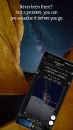
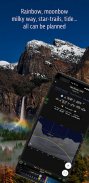
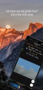
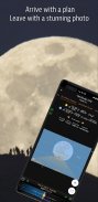
In a single app, we packed it with features - from location scouting such as GPS coordinates, elevations, distance, elevation gain, clear view, focal length, depth of field (DoF), hyperfocal distance and panorama, to the Ephemeris features such as the sunrise, sunset, moonrise, moonset time and direction, twilight time, special hours of the day, sun/moon finder, major stars, constellations, nebulae azimuth and elevation angle, star trail planning, time-lapse calculation and simulation, milky way searching, exposure/ND filter calculator, light meter, bulb timer, rainbow position prediction, tide search etc. All the information are either represented on the map as an overlay or visually presented in a simulated viewfinder (VR, picture, or street view), just like you look through your camera's viewfinder. Whatever you want for your landscape photography, it is there in the Planlt!.
در این برنامه رایگان، ویژگی Ephemeris به عنوان خرید در برنامه ارائه شده است که همانند PlanIt است! طرفدار بعد از خرید برخی از تصاویر موجود در اینجا ویژگی های Ephemeris را فعال کرده اند. نسخه رایگان با ویژگی های Ephemeris واقعا می تواند بسیاری از چیزهایی را که فکر می کنید انجام دهید. این یک خواننده فایل برنامه ریز / نشانگر، یک برآورد کننده فاصله کانونی بر روی نقشه، یک ماشین حساب DOF، یک ماشین حساب پانوراما، یک نقشه با ویژگی های نشانگر است. ویژگی های Ephemeris همه در هم ادغام شده اند، به طوری که ما برای ارائه برخی از ویژگی های کوتاه مدت در نسخه رایگان سخت است و از شما بخواهید برای بقیه پرداخت کنید. اگر چه ما محاکمه ای را ارائه نمی دهیم، لطفا خریداری کنید تا آن را امتحان کنید. اگر شما آن را دوست ندارید، می توانید هر زمان که بخواهید به شما بازپرداخت کنید.
آخرین ویدئو آموزشی در دسترس است
https://www.youtube.com/watch؟v=JFpSi1u0-is&list=PLTmlTTxPbBbcn1Fd1NRWTOczTY1RYEug4
===
این یک تماس ویژه به عکاسان چشم انداز، عکاسان سفر، عکاسان طبیعت و کسانی هستند که علاقه مند به عکاسی شبانه، عکاسی شهر، زمان گذشت، مسیرهای دنباله دار، راه شیری یا آستروفوتوری هستند: بیشتر به نظر نمی رسد، این برنامه نهایی برای شما است - Planit این تنها یک فنجان Frappuccino را به شما می دهد اما شما را به تناسب زمان و تلاش و پول زیادی صرفه جویی می کند. مهمتر از همه، آن را به شما لذت بردن از عکس های چشم انداز حتی بیشتر است.
آنسل آدامز ابتدای اولین کتاب خود "Taos Pueblo" را به تجسم اختصاص می دهد. او ایده "پیشگیری" را معرفی کرد، که عکاس را تصور می کرد که آنچه را که می خواست چاپ نهایی خود را قبل از اینکه حتی شلیک کند، می خواست. البته، بسیاری از عکس های بزرگ وجود دارد که به صورت انحصاری گرفته شد. با این حال، برای عکاسان چشم انداز، قادر به پیش بینی صحنه قبل از رفتن به آن، به احتمال زیاد به احتمال زیاد برای آماده شدن آماده می شود و به احتمال زیاد شانس گرفتن عکس بهتر را افزایش می دهد.
عکاسان از ابزارهای مختلف برای کمک به آنها از قبل از تجسم صحنه استفاده می کنند. امروزه بسیاری از این ابزارها برنامه های تلفن هستند. PlanIt! یک راه حل همه جانبه است که برای استفاده از نقشه ها و تکنولوژی های شبیه سازی منظره یاب طراحی شده است تا ابزار لازم برای عکاسان را برای پیش نمایش صحنه در ترکیب با زمینه های زمین و اشیاء آسمانی مانند خورشید، ماه، ستاره ها، ستاره دنباله دار و راه شیری.
در یک برنامه واحد، ما آن را با ویژگی های آن بسته بندی کردیم - از مکان هایی نظیر مختصات جغرافیایی، ارتفاع، فاصله، بلند شدن ارتفاع، نمای روشن، فاصله کانونی، عمق میدان (DoF)، فاصله فوکال فوکوس و پانوراما، تا ویژگی های اپیمری مانند طلوع خورشید، غروب خورشید، طلوع ماه، زمان قدمت و جهت، زمان گرگ و میش، ساعات خاص روز، نور خورشید / ماه، ستاره های بزرگ، صور فلکی، Azimuth سحابی و زاویه ارتفاع، برنامه ریزی دنباله ستاره، محاسبه زمان گذشت و شبیه سازی، راه شیری جستجو، نمایشگر / ND فیلتر ماشین حساب، متر نور، تایمر لامپ، پیش بینی موقعیت رنگین کمان، جستجوی جزر و مد و غیره تمام اطلاعات یا بر روی نقشه به عنوان پوشش داده شده و یا بصری در یک منظره یاب شبیه سازی شده (VR، تصویر، و یا نمایش خیابان) ، درست همانطور که از منظره یاب دوربین خود نگاه می کنید. هر آنچه که برای عکس های منظره خود می خواهید، در Planlt وجود دارد.
Planit: Photo Planner - نسخه 10.5.1
(20-02-2024)
Planit: Photo Planner - اطلاعات APK
نسخه APK: 10.5.1حزمة: com.yingwen.photographertoolsاپلیکیشنها در دسته مشابه
شاید دوست داشته باشید...


